ArcGIS

Esri mapping tools for data visualization

The Power of Data Visualization: How Esri’s Mapping Tools Simplify Complex Data

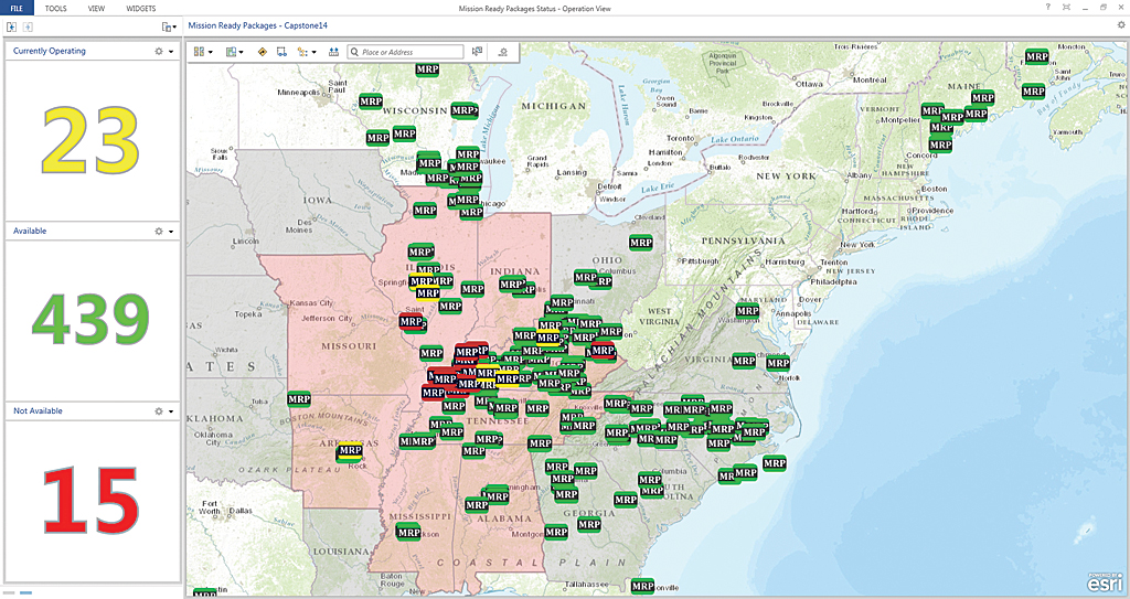
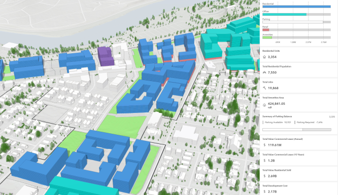
The Power of Data Visualization: How Esri’s Mapping Tools Make Complex Data Accessible In today’s world, data is everywhere. From businesses to government agencies, organizations collect vast amounts of data daily, but the challenge lies in transforming this information into actionable insights. The key to unlocking the potential of this data is effective data visualization. […]

The Power of Data Visualization: How Esri’s Mapping Tools Simplify Complex Data Read More »

Coral Reef - Conservation

Using Esri to Enhance Environmental Conservation Efforts

Using Esri to Enhance Environmental Conservation Efforts: Tracking Wildlife Populations and Habitats with GIS In an era where environmental conservation is more critical than ever, leveraging advanced technologies can make a significant difference. Geographic Information Systems (GIS) have emerged as powerful tools in the quest to protect our planet\’s biodiversity. Esri, a leader in GIS

Using Esri to Enhance Environmental Conservation Efforts Read More »

Esri Disaster Response

Improving Disaster Response and Management with Esri

Improving Disaster Response and Management with Esri: How GIS Technology Aids in Disaster Preparedness and Recovery In an era where natural disasters are becoming increasingly frequent and severe, effective disaster response and management have never been more critical. Geographic Information Systems (GIS) technology, particularly from Esri, plays a pivotal role in enhancing our ability to

Improving Disaster Response and Management with Esri Read More »

Consent Preferences
Scroll to Top