How Esri GIS is Revolutionizing Facility Management
In today’s rapidly evolving world, facility management is more than just maintaining buildings and infrastructure. It’s about optimizing space, improving operational efficiency, and ensuring the safety and comfort of occupants. One tool that is transforming how facilities are managed is Geographic Information System (GIS) technology. Esri, the global leader in GIS, is at the forefront of revolutionizing facility management through its suite of GIS tools.
What is Esri GIS?
Esri’s GIS software, such as ArcGIS, allows organizations to visualize, analyze, interpret, and manage geographic data. It enables users to layer and map spatial data to gain deeper insights into various aspects of their operations. In facility management, this technology provides a powerful means of integrating spatial information with asset management, space planning, and maintenance scheduling.
Enhancing Space Planning and Utilization
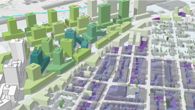
Effective space planning is crucial to ensuring that facilities are used optimally. With Esri GIS tools, facility managers can map out floor plans and analyze how spaces are being utilized. GIS allows them to visualize traffic patterns, identify underutilized areas, and even make real-time adjustments to room assignments based on usage trends.
For example, using Esri\’s ArcGIS, facility managers can create 3D floor plans and manage seating arrangements. This is particularly useful in environments like offices or educational campuses, where flexibility and efficient use of space are critical. By having accurate data on hand, managers can adjust layouts, allocate resources more effectively, and even make informed decisions on facility expansion or renovation.
Asset Tracking and Management
Keeping track of assets—whether it’s HVAC systems, elevators, lighting, or IT infrastructure—is a major challenge for facility managers. Esri GIS tools simplify this process by offering asset mapping and tracking capabilities. With GIS, assets are tied to geographic locations, which makes it easy to view, track, and manage their lifecycle.
For instance, by integrating sensor data and IoT devices, Esri\’s platform can provide real-time updates on the condition of critical assets. Facility managers can monitor equipment performance, schedule maintenance, and reduce downtime by detecting potential issues before they become costly problems.
With the help of GIS, facility teams can plan for future upgrades, create maintenance schedules, and ensure the longevity of assets by visualizing their conditions on an interactive map.
Streamlining Maintenance and Operations
Routine maintenance is vital for the smooth operation of any facility. Esri GIS can automate and streamline maintenance processes by allowing managers to create detailed maintenance schedules based on spatial data. This includes tracking preventive maintenance tasks, identifying high-priority repairs, and ensuring compliance with safety regulations.
For example, if a sensor detects a malfunction in an HVAC unit, Esri’s GIS system can instantly alert the maintenance team, pinpoint the exact location of the unit, and generate a work order. This integration of spatial data and real-time alerts significantly improves operational efficiency and reduces response time.
Improving Emergency Response and Safety
In large facilities or campuses, ensuring safety and quick emergency response is paramount. GIS technology plays a key role in emergency preparedness by providing real-time location-based data to facility managers and emergency responders.
Esri’s GIS tools can be used to create evacuation plans, track emergency exits, and plan for crowd management during emergencies. When an incident occurs, GIS can provide critical location data, ensuring that first responders can access the facility quickly and effectively. Additionally, facility managers can simulate emergency scenarios to improve training and response strategies.
Optimizing Energy Efficiency
As sustainability becomes a top priority for organizations, optimizing energy consumption is a key concern for facility managers. GIS tools from Esri can help monitor and analyze energy usage patterns within a facility. By visualizing energy consumption across different departments or zones, facility managers can identify inefficiencies, adjust usage behaviors, and implement strategies to reduce energy waste.
Esri’s GIS software can also integrate with environmental data to track the impact of facility operations on the surrounding ecosystem, helping to ensure that buildings meet sustainability goals.
Conclusion
Esri’s GIS tools are transforming facility management by providing a more efficient, data-driven approach to everything from space planning and asset tracking to maintenance and emergency response. The ability to visualize, analyze, and manage spatial data empowers facility managers to make informed decisions that lead to cost savings, operational efficiency, and improved occupant experience.
As the world continues to embrace digital transformation, Esri’s GIS technology is a powerful solution for facility managers looking to stay ahead of the curve. With better insights, smarter planning, and real-time data at their fingertips, facility management is being redefined for the future.
About IMS Consulting:
For over a decade, IMS Consulting has been at the forefront of delivering comprehensive services across multiple platforms, including Archibus, ServiceNow, and ESRI, to our diverse clientele in both public and private sectors. As a dedicated small business, we offer personalized attention from experienced and certified consultants. Our experts collaborate closely with clients to deeply understand their operational processes, identify unique requirements, and uncover opportunities for enhanced management of their infrastructure. We are committed to helping you make informed capital budgeting decisions that yield benefits today and sustainably into the future