Esri and the Future of Smart Cities: How GIS is Shaping the Development of Smart Cities
As urban populations continue to swell, the need for smarter, more efficient cities has never been greater. Enter Geographic Information Systems (GIS) technology from Esri, a game-changer in the realm of smart city planning and development. This blog explores how Esri\’s innovative GIS solutions are shaping the future of smart cities, highlighting key innovations and emerging trends.
The Role of GIS in Smart Cities
At its core, GIS technology enables the visualization, analysis, and interpretation of spatial data. For smart cities, this means integrating vast amounts of data from various sources to create a comprehensive, real-time view of urban environments. Here’s how Esri’s GIS technology is driving smart city development:
- Data Integration and Visualization
- Real-Time Data: Esri’s ArcGIS platform integrates real-time data from IoT devices, sensors, and other sources, providing city planners with up-to-date information on traffic, weather, energy usage, and more.
- Interactive Maps: These dynamic maps enable stakeholders to visualize complex data in an intuitive format, facilitating better decision-making and strategic planning.
- Urban Planning and Management
- Land Use and Zoning: GIS tools help planners analyze land use patterns, optimize zoning regulations, and predict future growth areas.
- Infrastructure Management: By mapping existing infrastructure, cities can plan maintenance activities, identify areas needing upgrades, and efficiently allocate resources.
- Public Safety and Emergency Response
- Crime Mapping: GIS technology assists law enforcement in identifying crime hotspots and deploying resources effectively.
- Disaster Management: During emergencies, GIS provides critical insights into affected areas, helping coordinate response efforts and resource distribution.
- Sustainability and Environmental Monitoring
- Green Infrastructure: GIS aids in planning and managing green spaces, ensuring cities remain sustainable and resilient.
- Environmental Impact Analysis: Tools like Esri’s ArcGIS Pro allow for detailed environmental impact assessments, promoting eco-friendly urban development.
 Innovations in Smart City Planning Using Esri Technology
Esri continues to push the boundaries of what’s possible with GIS technology. Here are some groundbreaking innovations that are transforming smart city planning:
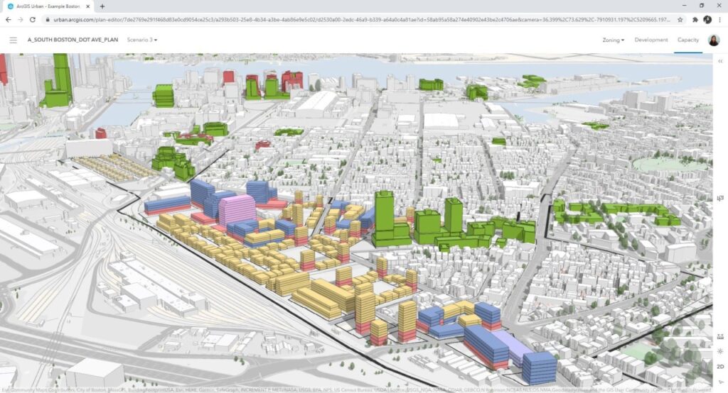
- 3D Modeling and Simulation
- Digital Twins: Creating digital replicas of physical assets, such as buildings and infrastructure, allows for advanced simulations and scenario planning.
- 3D Visualization: Tools like ArcGIS Urban provide 3D visualizations of city plans, enabling stakeholders to explore proposed developments from every angle.
- AI and Machine Learning Integration
- Predictive Analytics: Combining AI with GIS data enables cities to predict trends, such as traffic congestion or energy demand, and proactively address potential issues.
- Automated Insights: Machine learning algorithms can analyze large datasets to uncover patterns and generate actionable insights.
- Citizen Engagement Platforms
- Crowdsourcing Data: Platforms like ArcGIS Hub facilitate community engagement by allowing citizens to contribute data and feedback, fostering a collaborative approach to urban planning.
- Public Dashboards: Interactive dashboards provide residents with transparent access to city data, enhancing trust and participation.
Trends Shaping the Future of Smart Cities
As we look to the future, several key trends are poised to shape the development of smart cities using Esri technology:
- Increased Focus on Resilience
- Cities are prioritizing resilience planning to withstand natural disasters, climate change, and other challenges. GIS plays a crucial role in identifying vulnerabilities and developing mitigation strategies.
- Enhanced Mobility Solutions
- Smart transportation systems, powered by GIS, are improving urban mobility through real-time traffic monitoring, route optimization, and the integration of autonomous vehicles.
- Sustainable Development Goals (SDGs) Alignment
- Cities are aligning their development strategies with the United Nations’ SDGs, leveraging GIS to track progress and ensure sustainable growth.
- Smart Infrastructure
- The integration of smart technologies into urban infrastructure, such as smart grids and intelligent water management systems, is becoming increasingly prevalent. GIS helps manage and optimize these systems for maximum efficiency.
Conclusion
Esri’s GIS technology is at the forefront of smart city development, offering powerful tools to visualize, analyze, and manage urban environments. As cities continue to evolve, embracing these innovations will be key to creating more efficient, sustainable, and resilient urban spaces. By leveraging Esri’s cutting-edge solutions, city planners and stakeholders can navigate the complexities of modern urbanization and pave the way for the smart cities of tomorrow.
About IMS Consulting
For over a decade, IMS Consulting has been at the forefront of delivering comprehensive services across multiple platforms, including ARCHIBUS, ServiceNow, and ESRI, to our diverse clientele in both public and private sectors. As a dedicated small business, we offer personalized attention from experienced and certified consultants. Our experts collaborate closely with clients to deeply understand their operational processes, identify unique requirements, and uncover opportunities for enhanced management of their infrastructure. We are committed to helping you make informed capital budgeting decisions that yield benefits today and sustainably into the future.